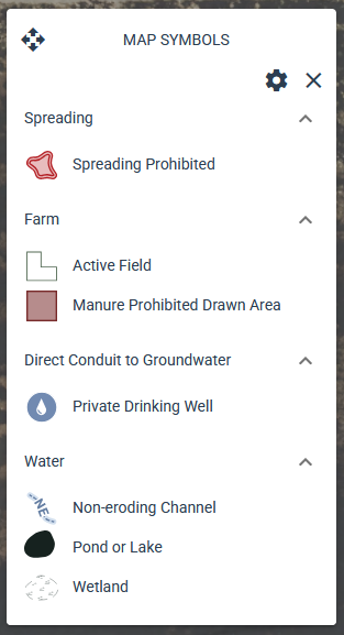
¶ Map Symbols
Each layer has a distinct symbol to help differentiate it from other layers on the map.
You can view these symbols in the map legend by clicking the map symbol tool 
¶ Key Features
-
Dynamic layer display
- The legend only shows layers that are turned on in the layers panel.
- If a layer isn't visible, its symbols will not appear in the legend.
-
Filter symbols by extent
- Only symbols for features currently visible in the map extent are shown in the legend.
- As you pan or zoom, the legend updates automatically to reflect what is on the screen.
- This setting can be turned off if you want to see all visible layers or don't want to wait for the filtering function to complete.
- Click the settings button

- Uncheck "Filter by map extent"

- Click the settings button
-
Draggable legend box
- The legend box can be moved around the map if its default position is covering features.
- Left click on the Map Symbols header

- Hold down the mouse button while you drag to a new location
- Left click on the Map Symbols header
- The legend box can be moved around the map if its default position is covering features.